
AgTech Drone Application Map Tool Market Outlook 2025–2035
A new report titled “Drone Application Map Tool Market – A Global and Regional Analysis: Focus on Application, Product, and Regional Analysis – Analysis and Forecast, 2025–2035” has been released on ResearchAndMarkets.com, providing an in-depth evaluation of the rapidly expanding drone mapping ecosystem. According to the study, the global market for drone application map tools is projected to reach $1.19 billion in 2025, and surge to $10.75 billion by 2035, reflecting an exceptional CAGR of 24.53%. This momentum is underpinned by rising infrastructure investments, the growth of agricultural reuse projects, increasing sustainability mandates, and the broader digital transformation of agrifood systems.
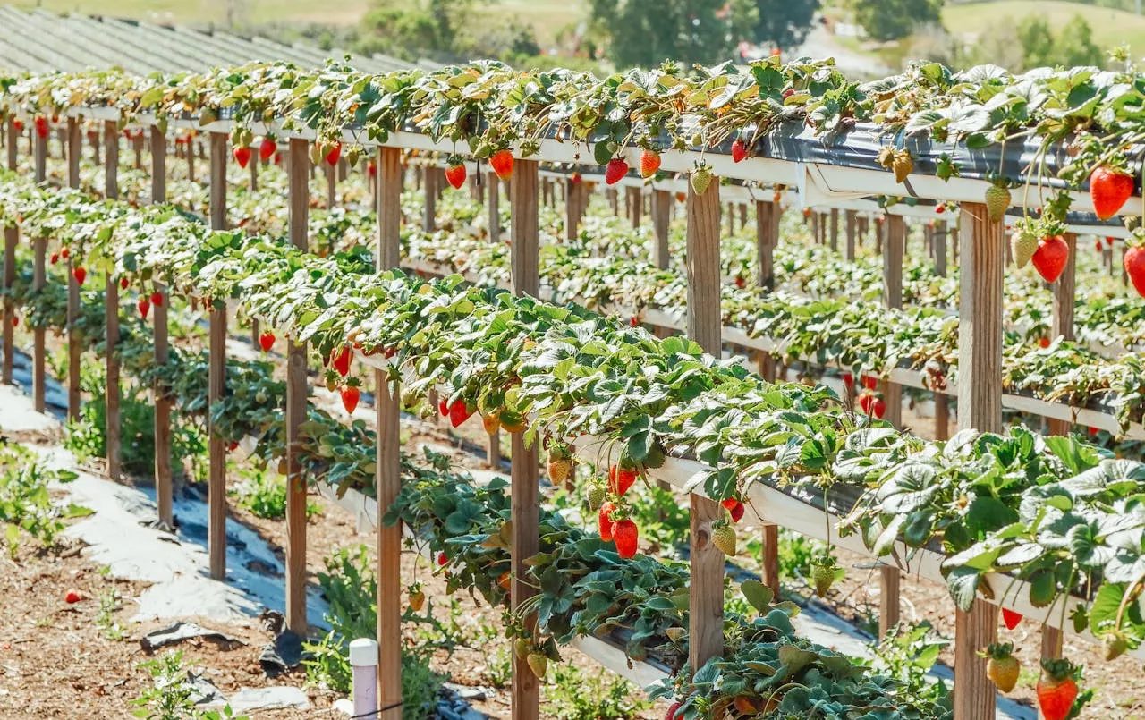
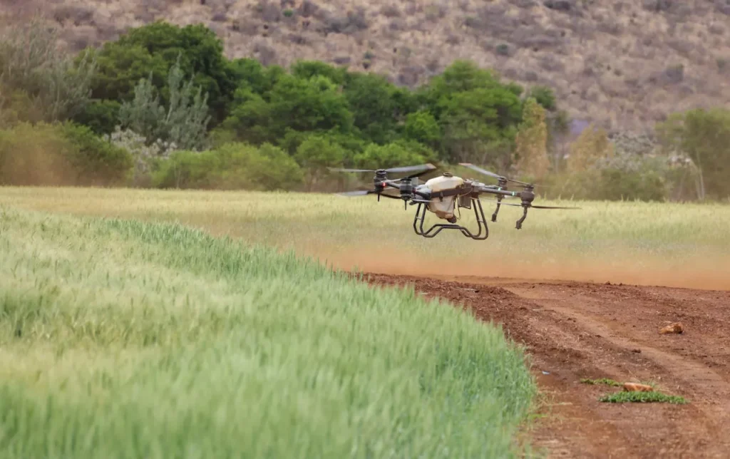
Drone application map tools occupy a crucial and fast-accelerating niche within the precision agriculture sector. These tools encompass the hardware, software, algorithms, and cloud-based services that transform drone-captured imagery into high-resolution maps, crop insights, and prescriptive agronomic actions. In essence, they enable farmers, agronomists, and service providers to monitor crop performance with a level of speed, accuracy, and spatial detail that traditional scouting or satellite-based monitoring cannot match. By converting raw aerial imagery into actionable intelligence, these tools unlock new pathways for precision decision-making—whether related to input optimization, crop health assessment, yield prediction, or environmental sustainability.
The demand for drone mapping solutions continues to rise as agriculture faces unprecedented pressures. The dual challenge of feeding a growing global population while preserving natural resources is pushing farmers to adopt highly efficient, data-driven practices. Drone application map tools are emerging as essential instruments in this transformation. Farms across major agricultural markets—including the U.S., Europe, India, Brazil, China, and Australia—are using drone-generated maps to fine-tune irrigation, detect pests and diseases earlier, evaluate plant vigor, and administer fertilizers or agrochemicals more precisely.
One of the biggest advantages of drone mapping is its ability to detect anomalies that are otherwise difficult to identify at ground level. For example, a drone equipped with multispectral sensors can instantly highlight nitrogen deficiencies, water stress, or early-stage fungal infections long before they are visible to the naked eye. This early detection empowers farmers to intervene quickly, reducing crop losses and minimizing unnecessary input costs. Such targeted interventions not only bolster profitability but also support environmental goals by reducing chemical runoff and over-application of fertilizers.
A key industry shift is the deepening integration between drone mapping tools and existing AgTech platforms. Most advanced mapping systems now sync seamlessly with farm management information systems (FMIS), allowing farmers to export prescription maps directly to GPS-enabled tractors, sprayers, and spreaders for automated variable-rate applications. This interoperability reduces manual data handling, accelerates workflows, and enhances the overall efficiency of precision input management.
Another emerging trend is real-time or near-real-time in-field processing. Historically, large drone datasets required lengthy uploads to cloud servers for post-processing, creating delays. Today, edge computing and onboard processing units allow drones to generate usable maps during the flight itself. This capability is especially beneficial for time-sensitive operations, such as rapid response to pest outbreaks or assessing storm damage immediately after a weather event.
IoT–drone data fusion is also gaining traction. Farms increasingly deploy soil moisture sensors, weather stations, and crop growth sensors. Integrating this ground-level data with drone-captured aerial maps offers a multi-dimensional understanding of field conditions. For instance, combining soil moisture readings with NDVI imagery provides a holistic view of where water stress is occurring and why. This ecosystem-level insight strengthens the accuracy of decision-making and improves long-term resource management.
From a hardware standpoint, the market is witnessing efforts to make traditionally expensive equipment more accessible. Hyperspectral sensors—once limited to research institutions—are gradually becoming more affordable and compact. These sensors can differentiate subtle spectral signatures, enabling extremely precise crop classification, disease detection, and nutrient profiling. As costs fall, hyperspectral technology is expected to penetrate mainstream crop monitoring applications, further enhancing the value proposition of drone mapping solutions.
Despite the strong growth trajectory, adoption remains uneven across regions and farm sizes. Large commercial farms in North America, Western Europe, and parts of Asia-Pacific have quickly embraced drone mapping because of their strong digital infrastructure, access to skilled labor, and clear ROI from precision agriculture investments. In contrast, smaller farms—particularly in developing regions—face barriers such as high upfront costs, limited drone operation expertise, and restrictive regulations governing UAV flights. In many of these regions, satellite imagery and manual scouting remain the dominant monitoring methods.
Addressing these adoption gaps will require a mix of policy support, farmer-training programs, and service-provider business models. Subscription-based solutions, drone-as-a-service (DaaS) offerings, and cooperative-based drone programs are expected to play an important role in democratizing access to advanced mapping tools.
Key Market Players and Competitive Landscape
The competitive environment of the drone application map tool market is dynamic and innovation-driven. Leading companies—such as Pix4D, DroneDeploy, Sentera (acquired by John Deere), PrecisionHawk, AgEagle, and MicaSense—are at the forefront of developing next-generation photogrammetry engines, analytics platforms, and automated mapping workflows. Their software solutions offer a blend of powerful image processing, machine learning tools, and agronomic capabilities tailored for various crops and geographies.
Competition is intensifying as firms race to differentiate themselves based on integration depth, processing speed, sensor support, and ease of use. Some platforms offer all-in-one solutions combining flight planning, real-time analytics, and automated reporting, while others position themselves as specialist photogrammetry engines intended for integration with broader farm management ecosystems. At the same time, drone manufacturers like DJI and Parrot continue to enhance the affordability and accessibility of drone hardware, creating a robust hardware–software synergy that benefits the entire market.
Companies are also forming strategic partnerships with ag retailers, input manufacturers, cooperatives, and equipment manufacturers to expand their reach. Mergers and acquisitions are reshaping the competitive landscape as larger agritech firms absorb smaller analytics startups to broaden their capabilities and geographic footprints.
Overall, the drone application map tool market is entering a transformative decade fueled by rapid advancements in UAV technology, AI-based analytics, automation, and AgTech interoperability. As adoption accelerates and barriers gradually diminish, drone mapping is set to become a mainstream component of global agriculture—reshaping how fields are observed, managed, and optimized across the world.
Source Link:https://www.businesswire.com/