Planet and Bayer Expand Enterprise License to Drive Digital Innovation in Agriculture
Planet and Bayer Labs PBC (NYSE: PL), a leading provider of satellite imagery and Earth observation data, has announced a significant expansion of its partnership with Bayer through a multi-year enterprise license agreement. This new agreement extends Bayer’s access to Planet’s high-resolution satellite imagery and analytics, broadening its application across commercial agricultural operations worldwide. By leveraging advanced geospatial data, Bayer aims to enhance decision-making, streamline logistics, and optimize agronomic performance across its global agricultural footprint.
This strategic collaboration builds on years of cooperation between the two companies, reinforcing their shared commitment to digital innovation in agriculture. By integrating satellite-based intelligence into its agricultural processes, Bayer is strengthening its capabilities in crop monitoring, supply chain optimization, and sustainable farming practices. The expansion of this agreement underscores the growing importance of remote sensing technology in driving efficiency and productivity in modern agriculture.
Leveraging Advanced Satellite Data for Smarter Farming
Under the new agreement, Bayer will have increased access to a suite of Planet products, including PlanetScope, Tasking, Fusion, Basemaps, and Planetary Variables. These tools provide frequent, high-resolution satellite imagery and real-time analytics, enabling Bayer to make data-driven agronomic decisions with unprecedented precision.
Planet’s satellite data is instrumental in helping Bayer’s teams monitor vast agricultural landscapes, detect early signs of crop stress, and optimize the timing of interventions. By continuously capturing imagery of fields, Bayer can enhance its oversight of research trials, improve logistics, and ensure that resources are deployed efficiently to maximize yields. Additionally, high-resolution remote sensing enables scalable, standardized phenotypic assessments, which support product development and long-term strategic planning.
Through Planet’s advanced imaging solutions, Bayer is also able to assess soil moisture levels, monitor plant health, and detect environmental changes with greater accuracy. This technology plays a critical role in mitigating risks associated with climate change, allowing Bayer to proactively adapt its strategies and promote more resilient agricultural practices.
Commitment to Regenerative Agriculture and Sustainability
Bayer has been at the forefront of promoting regenerative agriculture, a holistic approach to farming that enhances soil health, conserves natural resources, and improves biodiversity. The expanded enterprise license with Planet aligns with Bayer’s sustainability goals by providing actionable insights that help optimize resource use and minimize environmental impact.
“At Bayer, we are committed to harnessing cutting-edge technology to advance regenerative agriculture and enhance productivity,” said Christina Lawrence, Head of Seed Production Innovation at Bayer’s Crop Science Division. “Through this relationship with Planet, we are equipping our teams with powerful geospatial data to drive informed decisions, optimize operations, and deliver greater value to farmers around the world.”
By leveraging satellite data, Bayer can reduce unnecessary input usage, such as fertilizers and pesticides, thereby improving sustainability while maintaining high crop productivity. The ability to monitor fields with precision helps ensure that interventions are applied only when needed, reducing waste and promoting eco-friendly farming practices.
Enhancing Supply Chain Resilience and Operational Efficiency
In addition to improving on-farm decision-making, Planet’s satellite imagery supports Bayer in strengthening its agricultural supply chain. By providing real-time insights into crop conditions across different regions, Bayer can optimize logistics, predict harvest timelines more accurately, and ensure a more resilient food production system.
Supply chain disruptions have become a growing concern in the agricultural sector, particularly due to climate variability and geopolitical factors. By utilizing Planet’s high-frequency satellite imagery, Bayer gains better visibility into its supply chain, allowing for more agile responses to potential disruptions. This increased agility ensures that Bayer can meet demand more effectively and maintain consistent food production in an ever-changing global landscape.
Furthermore, Bayer’s research teams benefit from the enhanced ability to monitor crop performance at scale, facilitating the development of next-generation seed varieties that are more resilient to environmental stressors. This capacity to analyze vast amounts of agricultural data supports Bayer’s mission to drive innovation and advance the science of crop improvement.
Empowering Farmers with Data-Driven Solutions
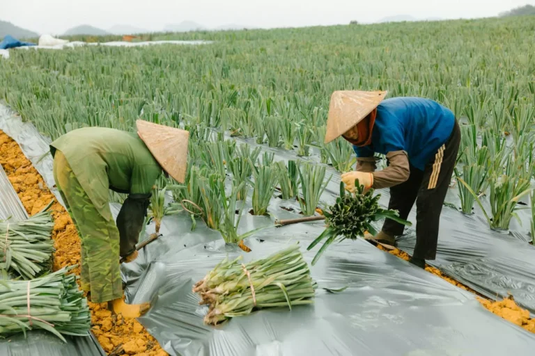
Farmers around the world face numerous challenges, from unpredictable weather patterns to fluctuating market demands. By integrating Planet’s satellite intelligence into its digital farming platforms, Bayer is equipping farmers with the tools they need to make smarter, data-driven decisions.
Through its precision agriculture initiatives, Bayer is working to provide growers with actionable insights derived from satellite imagery. These insights help farmers optimize irrigation schedules, identify pest or disease outbreaks early, and improve overall field management. The result is increased productivity, reduced input costs, and a more sustainable approach to farming.
Planet’s satellite technology also enables the collection of long-term data on soil health, crop rotation patterns, and land use changes. By analyzing these trends, Bayer can support farmers in adopting best practices that promote long-term soil fertility and ecosystem balance.
A Shared Vision for the Future of Agriculture
The expansion of the enterprise license agreement between Planet and Bayer marks a significant step toward the future of digitally-enabled agriculture. By deepening their collaboration, the two companies are driving technological advancements that improve agricultural efficiency, sustainability, and resilience.
“We are thrilled to expand our relationship with Bayer through this enterprise agreement,” said Charlie Candy, Chief Revenue Officer at Planet. “By providing Bayer with seamless access to our satellite imagery and analytics, we are empowering them to make more informed, data-driven decisions that not only drive productivity but also help reduce waste and create efficiencies within the agricultural ecosystem, ultimately contributing to more productive agricultural outcomes.”
As the agricultural industry continues to evolve, partnerships like this will play a crucial role in shaping the future of food production. By leveraging cutting-edge satellite technology, Bayer and Planet are working together to develop innovative solutions that support farmers, improve supply chain resilience, and promote environmental stewardship.
This agreement represents a long-term commitment to harnessing the power of geospatial intelligence for smarter farming. As Bayer continues to integrate satellite data into its agricultural operations, the company is setting new benchmarks for precision farming and sustainability in the global food system.
To learn more about how Planet’s satellite data is transforming the agricultural industry, explore Bayer’s Human Activity docuseries, which highlights the role of digital innovation in advancing regenerative agriculture. Through this collaboration, Bayer and Planet are not just driving productivity—they are shaping the future of farming for generations to come.